Free Lidar
Lidar is a surveying method that measures distance to a target by illuminating that target with a pulsed laser light.
The reflected pulses are measured by a sensor. It works in a similar way to radar, except light waves are used instead of sound waves. Differences in laser return times and wavelengths can then be used to make digital 3D-representations of the target.
Lidar survey readings are taken at a speed and magnitude that would take years to achieve by hand (600,000 pulses per second)
In the UK the Environment Agency has made a huge database of lidar scans, and these are available freely.
The bad news is that the scanning was done for flood management purposes - so any where not deemed part of a chain leading to flood risk wasn't surveyed. In addition they move the pages around, so be prepared to search. At the time of writing, these are two direct links but they may change in a year or so's time.
50 cm DTM lidar https://tinyurl.com/yawmwwml
1m DTM lidar https://tinyurl.com/y8q7sd4t
Historic England / English Heritage has surveyed some sites for archaeological purposes, but this information has to be applied for on an as and when basis. historicengland.org.uk/research/methods/airborne-remote-sensing/lidar/
This is a great example of an archaeological lidar survey, easily accessible online
www.wessexarch.co.uk/stonehenge/explore-stonehenge-landscape-lidar-survey
www.wessexarch.co.uk/stonehenge/explore-stonehenge-landscape-lidar-survey
On the Epiacum project website, there's an excellent example of a community archaeology project, where bespoke lidar scanning has been used to get an overview of the complex landscape surrounding the Roman fort at Whitley Castle near Alston.
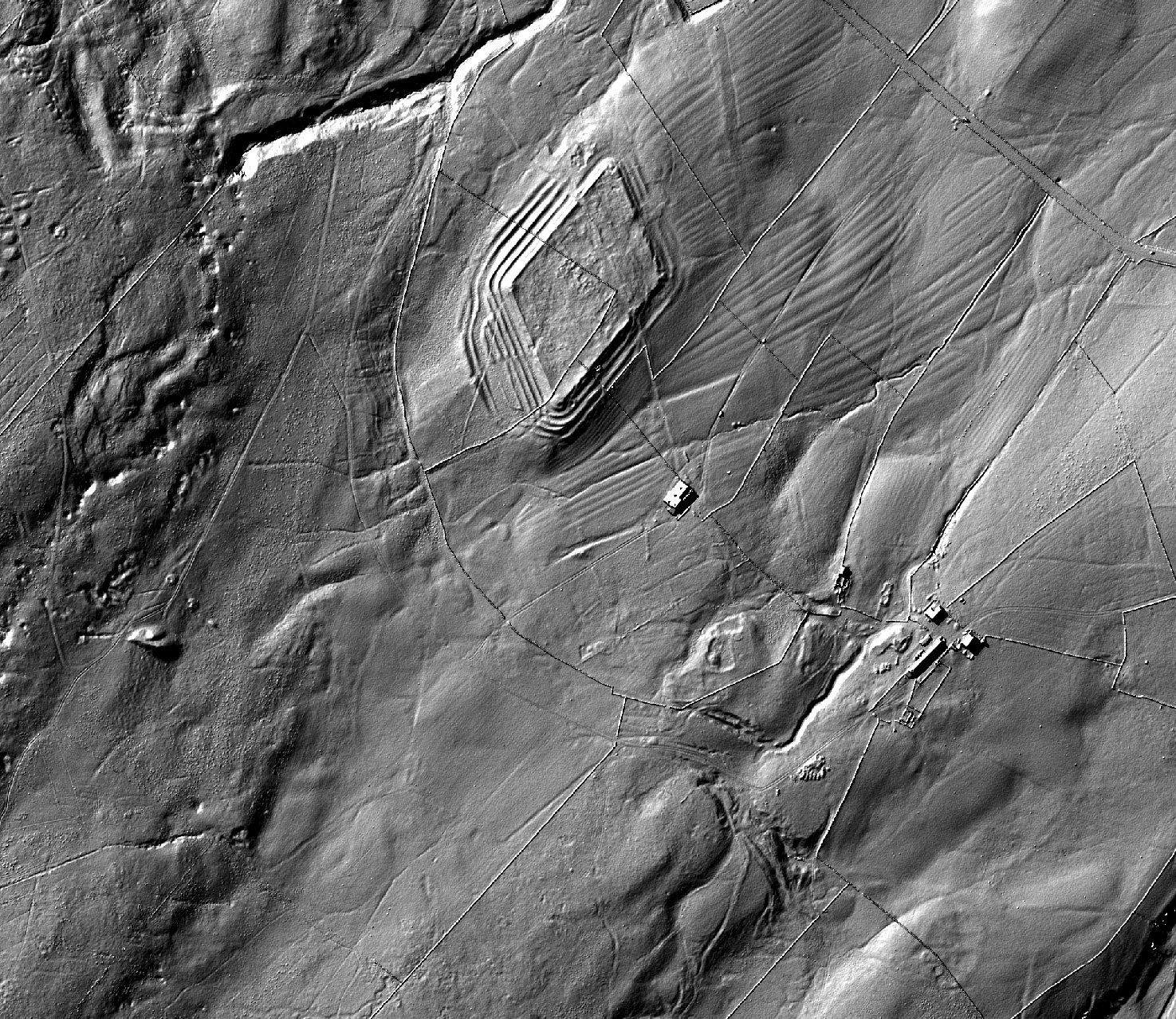
Lidar scan from Epiacumheritage.org
